
Walk an Alabaster Street Address
A useful Alabaster street directory search separates property evidence from household evidence. The county parcel map can connect a physical site to an assessed owner and a deed link. A deed then identifies parties to a land transfer. Neither source proves who sleeps at the address. A listed telephone subscriber or a properly obtained historical directory entry may add an occupant clue, but it still represents a dated snapshot.
- Enter the full address in Shelby County GIS and choose the suggestion marked Address, not an Owner or Parcel suggestion.
- Open the parcel and record its parcel number, boundary, and legal or subdivision context. Use a shape tool to select more lots on the same Alabaster street when needed.
- Follow the parcel's deed link, then search the instrument, party, date, or book and page in ROAM. The deed chain supplies owners, not a household roster.
- Request a narrow permit and inspection history from Alabaster Building when the property's work chronology matters.
- For older occupant clues, check a verified telephone or criss-cross source. Confirm that it is arranged by address before browsing it by street.
Write down the source date at every step. Alabaster parcels, listed telephone accounts, and permit files describe different moments. A current map should not be used to label a person found in an older directory.
Search Alabaster Streets in GIS
The official GIS is the strongest starting point for a present-day street search. Its basic autocomplete accepts an address, owner, or parcel number, and suggestions label the match type. Parcel numbers require spaces. The enhanced search can select a whole visible run of parcels rather than forcing a reader to repeat one address at a time.
| GIS control | How it helps a street search | Verified behavior |
|---|---|---|
| Basic search | Locates one starting property | Autocomplete accepts Address, Owner, or Parcel |
| Search layer | Limits enhanced selection | Parcel Owner or Subdivision by tax year |
| Shape | Selects a street segment or nearby lots | Point, line, extent, circle, polygon, and freehand choices |
| Buffer | Expands selection around a point or shape | Distance and unit controls; default example is 100 feet |
| Result actions | Reviews or saves selected parcels | Zoom, pan, flash, CSV export, and clear controls |
Selected parcels turn red and enter a results set. The viewer can export that set to CSV, email a share link, and connect an individual parcel to deeds. Those functions make the Alabaster street directory reproducible. They do not confirm every field that may appear in the separate Property Tax Citizen Access system.
Note: A parcel export is an ownership work list, not a list of Alabaster residents or every person at each site.
Alabaster Records Along a Street
No single Alabaster record provides a complete street directory. The useful chain combines sources that are keyed by a parcel, a legal instrument, or an exact address. Each keeper also offers a different access path when an online search falls short.
| Address source | Responsible keeper | Evidence supplied | Access route |
|---|---|---|---|
| Parcel map | Shelby County GIS | Boundary, assessed ownership, parcel-to-deed bridge | Free map and search |
| Recorded deed | Shelby County Probate Recording | Indexed parties, date, instrument, book/page, legal title | ROAM online or Room A401 books |
| Permit and inspection file | Alabaster Building and Engineering | Requested work and inspection chronology | City public-record request |
| Greater Shelby white pages | Library of Congress | Listed name, address, and telephone snapshots | Digitized annual run for 1974 through 1980 |
| Voter information | Alabama Votes and Shelby registrars | Self-status and polling geography | Name and birth-date self-lookup, not street browsing |
Online access is only the first channel. Probate Recording can help by phone at 205-670-5220 or in Room A401 at 112 North Main Street in Columbiana. Historical gaps may lead to Scott Library, the Shelby County Historical Society, the Alabama Department of Archives and History, or Library of Congress telephone holdings.
Read Alabaster Address Labels Carefully
Street research fails when three address systems are treated as one. The physical site starts the map search. Tax mail may go elsewhere. Older deeds may identify land without using today's number at all.
- Parcel
- A mapped unit of land used for tax and ownership records. One street address can involve more than one parcel.
- Situs address
- The address assigned to the physical property. It is distinct from the owner's mailing address.
- Plat
- A recorded map that lays out lots, blocks, streets, or subdivisions and can bridge old legal descriptions to current geography.
- Criss-cross directory
- A directory arranged by street or telephone number rather than only by surname. An alphabetical white-pages volume is not automatically criss-cross.
A matching mailing and site address can support, but never prove, owner occupancy. A mismatch may reflect a trustee, business entity, second address, or simple mailing choice. It does not establish why the addresses differ.
Link Alabaster Parcels to ROAM
ROAM, the Shelby County recorded-instrument index, does not offer a street-address field. The parcel and legal description create the bridge. Start with the deed link in GIS, capture its instrument or book and page, then use those identifiers in the probate index. Party searches support Starts With, Contains, Exact, and Phonetic matching, which helps when names were indexed in more than one form.
The official ROAM search exposes instrument, recording-date range, last and first names, document type, book/page, and map book/page. It also includes Boolean connectors and several sort orders. Shelby County states that deeds from 1819 to the present are online, a notable span for an Alabaster street directory.
The official recorded-instrument search below shows how Shelby County exposes those controls.
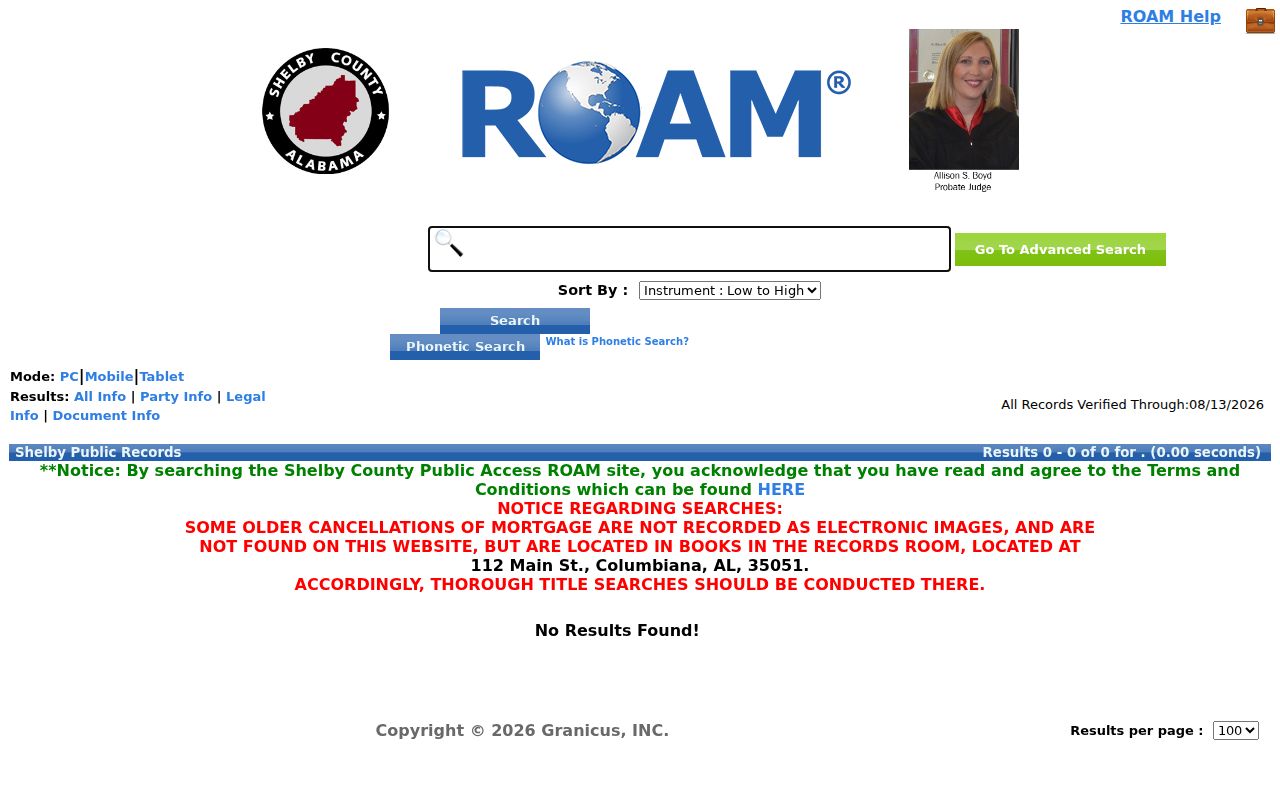
The screen confirms an index with several ways to narrow a deed trail. A zero result is not final because spelling variants, old document labels, and offline book annotations can change the search.
When Alabaster Deeds Leave Screens
The county's online range is broad, but the records room remains the complete official repository. ROAM warns that some old mortgage cancellations lack electronic images. A search that stops at the web interface can therefore miss a later notation affecting an otherwise visible instrument.
Take the instrument number, book/page, party variants, and the parcel's legal description to Probate Recording. Copies are listed at $1 per page. The office is open Monday through Friday from 8:00 a.m. to 4:30 p.m.; recording questions can also begin by telephone. For a city permit gap, use Alabaster's request form by mail, email, fax, courier, or in person and describe the exact address, file type, and date band.
Historical transcriptions report that people carried records from the Shelby courthouse during an 1891 fire. Most survived, though some probate or collector material may have been lost. That story is a reason to ask about the exact series, not proof that every missing Alabaster street record burned.
Note: Ask whether a blank year reflects a lost record, an unindexed book, a renamed series, or material held by an archive.
Alabaster Streets Cross Old Names
Modern Alabaster geography can hide older index terms. The city incorporated in 1953 and merged with Siluria in 1971. Earlier deeds, directories, and news items may describe rural Shelby County, Siluria, a subdivision, or a section-township-range description instead of Alabaster.
Postal geography adds another layer. A parcel inside Alabaster may retain a Maylene 35114 identity. Directional suffixes such as SE, NE, SW, and NW, plus numbered avenues, should be copied exactly. No verified citywide renumbering date, street-name crosswalk, grid origin, or E911 assignment office was found, so the street directory must not invent one.
Try Alabaster, Siluria, and Maylene only when the date and place make the variant plausible. Confirm a postal clue with an exact-address USPS lookup and the parcel with GIS. A post-office page proves the facility's postal last line, not the limits of every delivery route.
Request Alabaster Records by Address
Alabaster Building and Engineering uses LAMA for applications, but the research did not verify LAMA as an open historical address index. The city's published answer directs someone seeking a house's permit and inspection history to make a paid public-record request. A sound request names the exact address, a focused date range, and the desired permit, inspection, or certificate-of-occupancy files.
The City Clerk routes public files, while Building and Engineering handles its specialized records at 1953 Municipal Way, Suite 102, and 205-664-6823. City policy permits inspection during its stated access hours and may require clarification, prepayment, or a deposit for larger work. Asking to inspect first can reduce unnecessary copy costs.
Permit chronology can date additions or major work. It does not identify everyone who occupied the property. For current street ownership, return to the county parcel and deed chain; for older listed occupants, use the historical directory shelf rather than stretching a permit name beyond what the file proves.
Reverse Older Alabaster Street Listings
The verified Greater Shelby white-pages sequence runs annually from 1974 through 1980, including a July 1978 Library of Congress volume with 439 images. Those books show listed names, addresses, and telephone numbers. They should not be described as full household rolls, and an address browse is valid only if the issue includes a street-address or criss-cross section.
When a digitized volume lacks the needed arrangement, Library of Congress staff can assist with Street Address, Criss-Cross, Telephone Book, and City Business holdings. The Alabama Department of Archives and History holds Birmingham suburban directory runs and Shelby County directories for 2000 through 2002, though Alabaster coverage must be checked inside each title. Scott Library offers HeritageQuest remotely to county cardholders and onsite access to other genealogy and newspaper databases.
Detailed collection coverage belongs in the Alabaster city directory. Here, each old listing serves one limited purpose: it supplies a dated address clue that can be tested against a deed, census, obituary, or permit record.
Alabaster Voter Search Is Personal
Alabama VoterView is not a browseable street directory. Its self-service search requires a first name, last name, date of birth, and CAPTCHA. A separate polling-place search accepts a residential location, but returns voting geography rather than names at that address.
Registration applications are not public without written consent under Alabama law. Public poll lists are oriented to names and precincts, not household addresses. Protected domestic-violence voters remain named where required, but their residence and mailing addresses are omitted from public products. No historical Alabaster poll-book years were verified online.
Key limit. A voter tool can confirm one's own status and polling place; it cannot be used to assemble residents along an Alabaster street.
Limits of Alabaster Street Records
Official address records leave important people out. Assessed ownership does not establish occupancy. Renters, children, relatives, unlisted telephone users, and other household members may never appear in a parcel or deed index. A telephone listing identifies a subscriber, not all people at the site. Permit applicants and deed parties also may live elsewhere.
Motor-vehicle addresses remain restricted under the federal Driver's Privacy Protection Act. Voter applications and protected addresses have their own limits. No public utility-customer directory or complete official Alabaster household list was verified. The careful result is often a dated owner or subscriber clue, not a declaration of who lives there now.
Lawful use. Use Alabaster street records for property history, genealogy, civic research, or personal safety. Never use an address trail to stalk, harass, threaten, or harm anyone.