
Alabaster ZIP Coverage at a Glance
Two codes are verified as serving Alabaster in the research: 35007 and 35114. The first is the core Alabaster postal identity. The second carries Maylene history through western and annexed parts of the city. Two nearby codes, 35137 and 35144, should be treated as address-level questions rather than added to a broad city list without proof.
| ZIP | Areas Covered | Post Office | Research Note |
|---|---|---|---|
| 35007 | Verified Alabaster core | 50 Kent Stone Way | Primary Alabaster facility; retail and PO-box service |
| 35114 | Maylene and western annexation geography | 10011 Highway 17 | USPS facility shows an Alabaster last line while parcels may retain Maylene identity |
| 35144 | Siluria edge and nearby facility | 637 11th Avenue SW | Ordinary city-address role or PO-box-only role remains unverified |
| 35137 | Saginaw edge and nearby facility | 858 Highway 31 | Not proven to serve addresses inside current Alabaster limits |
This Alabaster ZIP code directory does not turn a facility location into a service polygon. A post office can be near an address without delivering to it, and a postal last line can remain in use after a parcel joins the city. Exact-address confirmation is the safe standard.
Alabaster ZIP Code 35007
The USPS Alabaster Post Office record verifies the 35007 facility at 50 Kent Stone Way. Retail hours are Monday through Friday from 8 a.m. to 4:30 p.m. and Saturday from 9 a.m. to noon. PO boxes are accessible around the clock. Those facts establish the facility and postal identity, not the exact outer edge of every delivery route.
View the official USPS Alabaster Post Office source captured below.
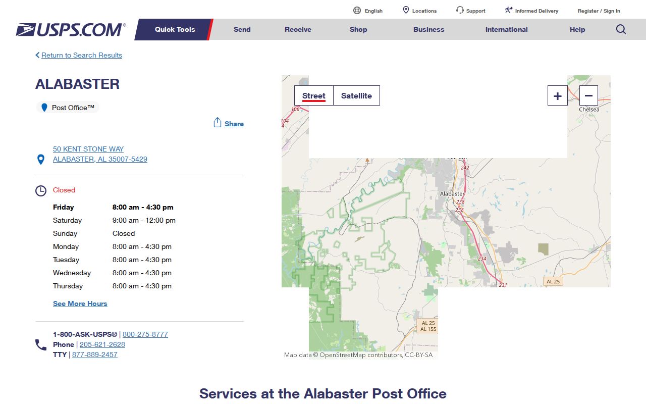
The page is useful for checking the post office name, services, and listed hours before a visit. Use the separate USPS address tool when the question is which code belongs to a particular home.
Within Alabaster, Highway 31, Interstate 65, Highway 119, Old Siluria, Weatherly, and Simmsville are useful route words. They help orient a search but do not mark postal borders. Named subdivisions such as Kingwood, Grandview, Lake Forest, Buck Creek, Mountain Lakes, and Wynlake are also search clues, not ZIP definitions.
Alabaster ZIP 35114 Keeps Maylene
The USPS Maylene Post Office record lists the facility at 10011 Highway 17 and displays an Alabaster 35114 postal last line. Yet Shelby County parcel examples and local reporting can still use Maylene. That is not necessarily an error. Postal language and municipal jurisdiction can coexist on different layers.
View the official USPS Maylene Post Office source captured below.
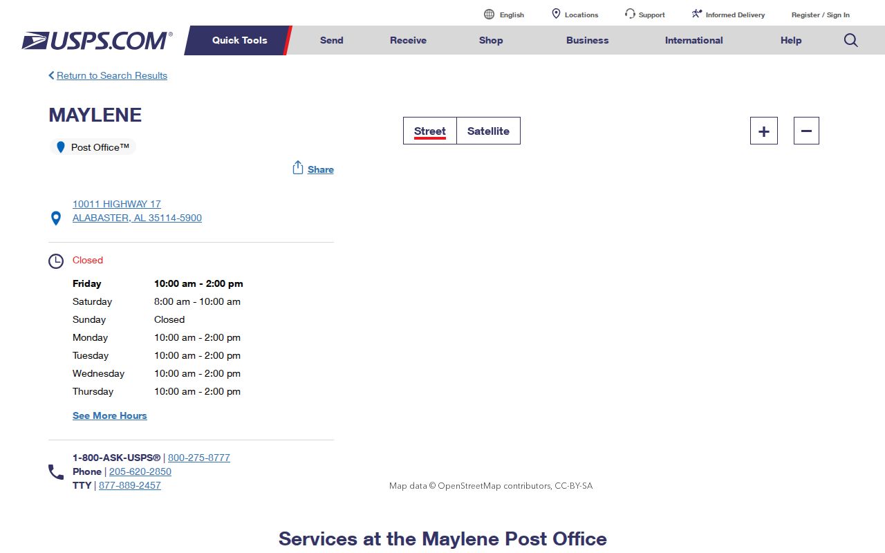
The image verifies the facility page, while a parcel map is still needed to answer whether one 35114 address lies within Alabaster.
A documented example at 150 Copperhead Road uses Maylene, Alabama 35114 even though it is discussed as an annexed Alabaster parcel. Creek View school reporting also uses Maylene 35114 and describes unincorporated overlap. This geography quirk is why a resident record should preserve both the postal label and the city-limit finding.
Find Alabaster Residents by ZIP
A reliable Alabaster ZIP code directory search moves from a postal answer to the official record that fits the question. The research did not verify a ZIP-wide filter in Shelby County Property Tax Citizen Access. It also did not confirm a ZIP layer in the live GIS. Do not promise either feature. Search an exact address, then inspect the returned parcel and jurisdiction.
- Enter the full street address in the USPS ZIP lookup. Record the standardized city, state, ZIP code, and any ZIP+4 returned.
- Open Shelby County GIS and locate the same address. Check the parcel and available city-limit or annexation context.
- Keep situs and mailing fields separate. The situs is the site location; the mailing field can point to a different place or PO box.
- Use the parcel owner as a property clue, not as proof of every resident. Ownership and occupancy are different facts.
- If the address remains unclear, ask Alabaster Planning and Zoning or Shelby GIS/911 which agency assigned the site address.
Once the code has narrowed a search to an exact road or subdivision, the Alabaster street directory process can carry the work to parcels and deeds. The ZIP step should narrow the geography, not replace address-level evidence.
Alabaster USPS Search Fields
The USPS location search provides several routes, but only an exact street-address lookup answers the resident-address question. A city-and-state search finds nearby postal facilities. A ZIP search does the same. Those results should not be read as a map of all homes served.
| Search Control | Input | Best Use | Limit |
|---|---|---|---|
| Street Address | Full site or mailing address | Verify the ZIP assigned to one address | Does not establish city jurisdiction |
| City and State | Place name plus Alabama | Find postal facilities near Alabaster | Facility list is not a delivery boundary |
| City or ZIP | Place name or five-digit code | Find services tied to a postal place | Cannot prove a parcel lies inside city limits |
| Location Type | Post office, retailer, box, kiosk, or collection box | Narrow the type of postal service | Describes service points, not residents |
A USPS result and a Shelby parcel result can both be correct while using different place names. Save each result with its date. Postal tools, annexation records, and property maps may change on different schedules.
Note: Use the street-address field for a home; a facility search alone cannot verify the ZIP assigned to that parcel.
Alabaster ZIP and City Limits
Alabaster incorporated in 1953 and merged with Siluria in 1971. Later annexations occurred parcel by parcel. A mailing identity may therefore outlast the boundary change that brought land into the city. Conversely, an Alabaster postal line does not guarantee that the site receives Alabaster municipal services.
The research found no official citywide renumbering date, street-name crosswalk, grid origin, E911 addressing office, or ZIP split year. Alabaster Planning and Zoning, reached through Building and Engineering at 205-664-6823, is the best city referral for annexations, plats, and official maps. Shelby GIS or 911 should be asked about an assigned site address.
- ZIP code
- A USPS routing code. It is designed for mail delivery and is not a municipal boundary.
- ZIP+4
- The five-digit code plus four more digits that refine a delivery segment or group.
- PO-box ZIP
- A code or use tied to post-office boxes rather than a home’s physical site.
- Unique ZIP
- A code assigned to one large organization or destination; none was verified for Alabaster.
- Carrier route
- A postal delivery path that may cross neighborhood or government boundaries.
Check Alabaster Edge ZIPs Carefully
Codes 35137 and 35144 appear near Alabaster geography, but the research could not prove their ordinary role inside the current city. The 35137 facility at 858 Highway 31 is associated with the Saginaw edge. The 35144 facility at 637 11th Avenue SW sits near the Siluria edge. Neither facility page, standing alone, proves that homes within Alabaster use that code.
Test one address at a time. First run the exact address through USPS. Then compare the same site with Shelby GIS and any city-limit layer or annexation record. If USPS returns an edge code while the parcel appears inside Alabaster, retain both facts. If the boundary cannot be verified, label the result unresolved and contact the agency that assigns or maintains the address.
No sound per-ZIP population or registration totals surfaced. The citywide 2020 population and later estimate cannot be divided among ZIPs without an authoritative crosswalk. Likewise, route names and subdivision lists are good query vocabulary but not valid substitutes for postal polygons.
Alabaster Voter Tool Is Personal
Alabama VoterView is a self-lookup, not a browseable roll of people within a postal area. It requires first name, last name, date of birth, and a CAPTCHA. Its purpose is to return registration status, ballot status, polling location, and address for the registrant. The separate polling-place search takes a residential address and returns voting geography, not names linked to that address.
Applications and update forms are not public without written consent under Alabama law. Public poll lists are organized around names and precincts rather than open household addresses, and protected domestic-violence voter addresses are omitted from public products. The Shelby County Board of Registrars can answer status or correction questions at 205-669-3913. A PO box alone does not meet the physical-residence rule.
This limit prevents a postal code from becoming an official household roll. It also means no registration count should be inferred for 35007 or 35114 from VoterView. Use the tool only when the required personal facts are already known for a lawful self-check.
Separate Alabaster Address Types
Four address forms can appear in one Alabaster ZIP code directory search. The postal address is standardized for mail. The situs address identifies the physical site on a parcel record. The owner mailing address tells the county where to send a tax notice and may be elsewhere. A legal description identifies land through lot, block, subdivision, section, or other recorded terms rather than a postal street line.
Do not merge these fields into one claim. A PO box does not show where a person sleeps. A tax mailing address does not show who occupies the parcel. A legal description can remain stable while the street label changes. Even a deed owner may differ from a current resident.
Historic searches add another layer. Try Alabaster, Siluria, Maylene, Saginaw, and rural Shelby County according to the year. Alabaster’s old mill and municipal history make Siluria especially important, while the western annexation pattern keeps Maylene active in modern postal evidence.